 EN
 Romana
6295.png "CHCNAV") CHCNAV RS7 RENTAL
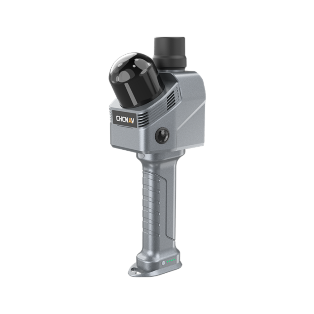
CHCNAV RS7 is a high-performance portable 3D LiDAR SLAM scanner designed for construction, indoor surveying, and 3D mapping applications.
By combining high-precision INS and SLAM, a high-accuracy IMU, and a LiDAR scanner capable of capturing up to 1.15 million points/s, the RS7 enables fast and accurate 3D data acquisition. Its ultra-wide 360° × 189° field of view, dual HD cameras, and support for 3D Gaussian Splatting enable detailed and realistic 3D models.
Ediție:
Product Code:
C463
Do you need help?
0770531656
- Description
- Reviews (0)
| Specifications | |
|---|---|
| Key Features | High-frequency LiDAR with a measurement rate of up to 1.15 million points/s and an ultra-wide 360° × 189° field of view |
| High-precision IMU | Gyroscope bias instability of 0.5°/hour for stable motion tracking and reliable SLAM results |
| HD Imaging System | Dual 48 MP cameras for clear images, point cloud colorization, and photorealistic 3D model generation |
| 3D Gaussian Splatting | CHCNAV HPGS 2.0 engine for generating 3D Gaussian Splatting models |
| Expansion Interfaces | Open hardware interface and SDK support for expanding functionality |
| Key Benefits | |
| Scanning | Portable 3D SLAM LiDAR scanning |
| Maximum measurement rate | 1,152,000 points/s in Dual Return mode |
| Field of view | 360° × 189° |
| IMU | 500 Hz |
| Gyroscope bias instability | 0.5°/hour |
| Cameras | Dual 48 MP cameras |
| 3D Gaussian Splatting | 3D Gaussian Splatting support |
| Absolute accuracy | Up to <3 cm RMS |
| Relative accuracy | <1 cm |
| Repeatability | <2 cm |
| Internal storage | 512 GB |
| Battery life | Up to 150 minutes |
| Weight | 1.2 kg with handle and battery |
| Protection | IP64 |
| Connectivity | 2.4 / 5 GHz Wi-Fi and Bluetooth 5.3 |
| Applications | |
| Application | Indoor surveying and mapping |
| Application | Construction |
| Application | 3D surveying |
| Application | Building and infrastructure documentation |
| Application | Point cloud generation |
| Application | 3D modeling |
| Application | Digital reality and 3D reconstruction |
| Application | Corridor, staircase, and complex space scanning |
| Application | 3D Gaussian Splatting model generation |
| General System Performance | |
| Absolute accuracy | H: <3 cm RMS / V: <3 cm RMS |
| Relative accuracy | <1 cm |
| Repeatability | <2 cm |
| Power mode | Battery integrated into the handle |
| Battery capacity | 47.5 Wh |
| Operating time | 150 minutes (one battery) |
| Power consumption | 16 W |
| Data storage | 512 GB |
| Weight | 1200 g with handle and battery |
| Operating temperature | -20 °C to +50 °C |
| Protection rating | IP64, according to IEC 60529 |
| Laser Scanner | |
| Laser classification | Class 1 – Eye-safe |
| Range | 40 m @ 10% reflectivity |
| Channels | 64 |
| Maximum effective measurement rate | Single Return: 576,000 pts/s / Dual Return: 1,152,000 pts/s |
| Field of view | 360° × 189° |
| Wavelength | 905 nm |
| Positioning and Orientation System | |
| GNSS system | GPS L1, L2, L5 / GLONASS L1, L2 / BeiDou B1, B2, B3 / Galileo E1, E5a, E5b |
| IMU update rate | 500 Hz |
| Gyroscope bias instability | 0.5°/hour |
| Gyroscope random walk | 0.01°/√hour |
| Accelerometer bias instability | 10 µg |
| Accelerometer random walk | 0.017 m/s/√hour |
| Camera | |
| Number of cameras | 2 |
| Resolution | 48 MP |
| Sensor size | 1/2 inch |
| Field of view (FOV) | 340° (H) × 360° (V) |
| Communication | |
| Wi-Fi | 2.4 GHz and 5 GHz, IEEE 802.11n/ac (U-NII-1/3) |
| Bluetooth | V5.3 (BR + EDR + BLE) |
| Ports | 1 × USB V3.0 Type-C for data download / 1/4″ mounting thread |
| Optional Software | |
| SmartGo | Data acquisition control, real-time point display, etc. |
| CoPre | POS processing, adjustment and refinement, point cloud generation, 3D modeling, colored point clouds, 3D mesh models, and 3D Gaussian Splatting (3DGS) |
| CoProcess 2025 | Point cloud processing with integrated CAD tools |
| Package Contents | |
| Included Product | 1 X CHCNAV RS7 |

If you want to express your opinion about this product you can add a review.
write a review
Similar products